ortho-photo Service
“Creating high-resolution Orthophotos by applying various image enhancement techniques and edge sharpening measures, making it suitable for various uses”
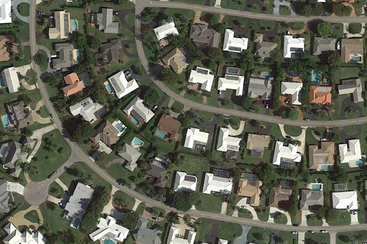
Wonder Geo aims at creating high-resolution Orthophotos by applying various image enhancement techniques and edge sharpening measures, making it suitable for various uses. Our digital Orthophotos provides an accurate measure of distances and hence, can be used as base maps or for visualization tools like Google Earth, WMS, etc.
An Orthophoto, also known as Orthophotograph, is an aerial image geometrically corrected to make its scale uniform. Production of an Orthophoto involves the correction and adjustment of the distortions of the lens, topographical relief or camera tilts.
Our precision-oriented generation of Orthophotos involves seamline feathering technique and balancing of an image, which ensures uniformorthomosaics. In this process of generation, we ensure accuracy by comparing the ground points in a rectified image with the real coordinates of the points.
What You Will Get With Our Orthophoto Production Services
Wonder Geo has proven best in offering orthophotograph production services and digital planimetric map production to various engineering and construction enterprises. Our services include:
- Ortho Mosaicking services.
- Geo-referencing.
- Construction of base maps for GIS.
- Seamline editing, color balancing and tile cutting in orthophotos.
- Orthorectification services of satellite images.
- Digitization services.
- Transformation services between various digital formats.
- CAD services.
- Architectural services.
- 2D and 3D rendering
- Drawings of constructions
- GPS surveying
What we do:
- 3 Band Orthophoto Production
- 4 Band Orthophoto Production
- Ortho Production through Lidar Route
- Pan Sharpened Ortho products from Multispectral Satellite Imagery