GIS DATA ANALYSIS & MAPPING
“Reliable GIS Data Analysis and Mapping services by our team of mapping experts”
Wonder Geo Mapping (WGM) provides the best GIS data analysis and mapping services to assist its customers across the globe. These services give a supporting hand to the customers in geo-visualization (geographic visualization), rich analysis of spatial data, integrations maintenance of data and effective management. By using our effective GIS services, data from various sources can be encoded into a common format, making it easy for various functions such as analyzing or utilizing.
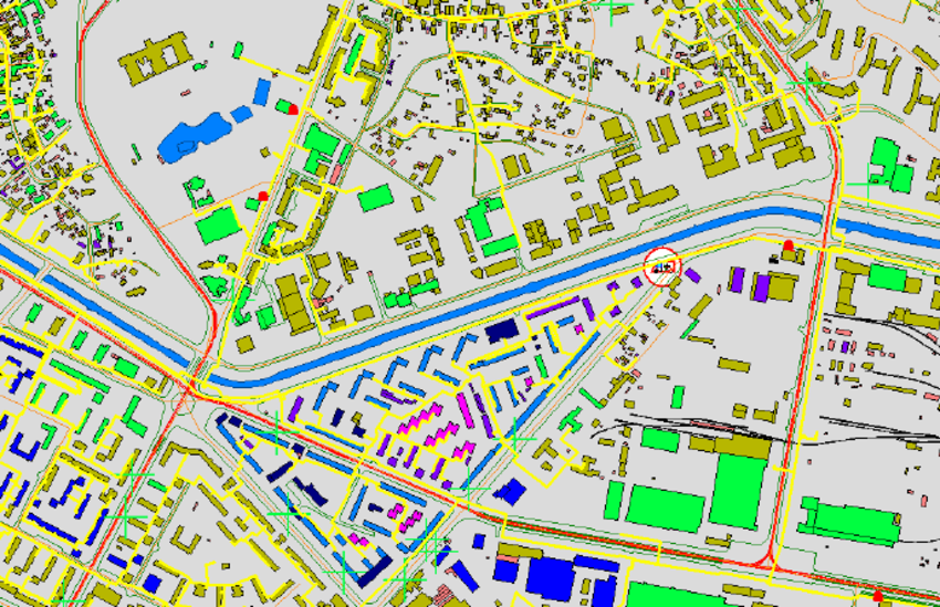
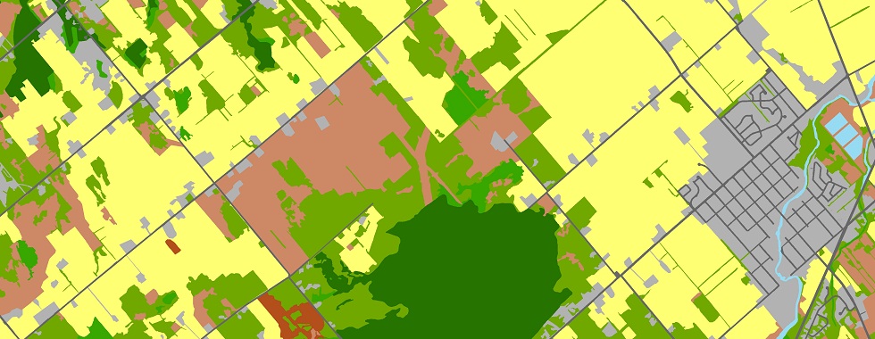
With great proficiency, knowledge, and experience, we manage to use CAD (Computer-Aided Design), GIS and GPS services integrally. This is accomplished through GIS mapping and sophisticated data conversion software, which allow the customers to create several ranges of maps like cadastral maps, topographical maps, contour maps, atlas maps, spatial maps, and thematic maps. These maps are widely used across several industries such as telecommunication, town planning, mining, agriculture, utility services, urban development, transportation networks, etc.
Wonder Geo provides a better understanding of spatial patterns and relationships to various industries and organizations through sophisticated GIS mapping services and GIS remote sensing services. These services include seizing, storing, checking, consolidating, analyzing and displaying data related to positions on Earth’s surface.
We have a dexterous team of well-trained and highly qualified professionals who are committed to creating maps using advanced technology and measures. Our team of esteemed engineers, scientists and planners has consolidated GPS, CAD and GIS to develop various GIS products and systems that can be used widely for designing and architecture, producing and analyzing maps, training of users and 3 D modeling.
Benefits of Choosing Our GIS Mapping & Data Analysis Services
- We effectively manage to help our customers in taking better decisions regarding a particular geographical location by displaying spatial and no-spatial data in the form of dynamic maps.
- Our GIS mapping services analyze the data regarding a particular geographical location through various sources like surveys, satellite pictures, etc. This method of analyze is carried out with CAD, GPS and GIS systems.
- With the help of geospatial data analysis, our GIS mapping services have enhanced the power of decision making among various individuals and businesspersons.
- Our GIS mapping services allow smooth functioning and implementation through data collection services, effective data management, high-end production, and delivery.
What we do:
- Base Map Creation
- Cadastral Mapping
- Parcel Mapping
- Topographic Mapping
- Utility Mapping
- Landuse Mapping