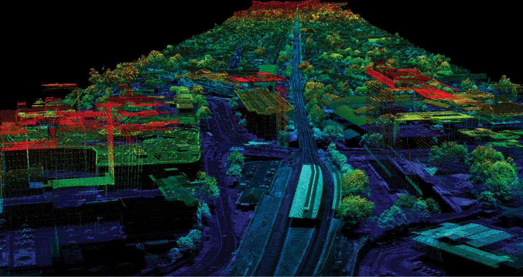
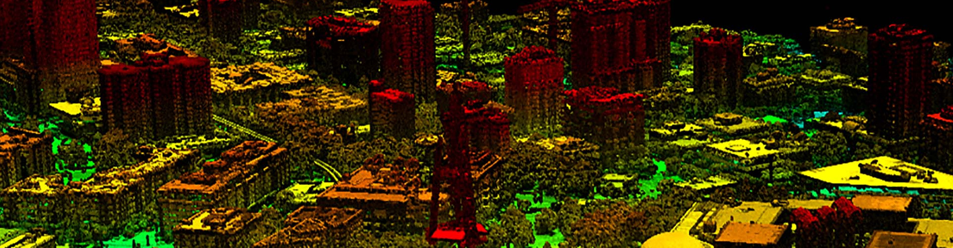
Lidar Service
“The best and effective method to create spatial data and is being widely used for a multitude of applications, including 3D Modeling, Topographic Mapping, Infrastructure, to name a few.”
WGM can assist you to find various data for your survey work across the world. Our wide network of trusted partners across the globe endeavor to provide high-quality LiDAR services on any platform including ALS and MLS, with the promise of cost-effectiveness.
Our LiDAR data processing services assist in the creation of DEM, Triangular Inverse Networks (TIN) and Digital Terrain Models (DTM), providing precise details of the earth’s surface. Our services have proven beneficial in enhancing the power of decision-making among various businesspersons. LiDAR services have helped many public utility services including water, gas, and electricity by supporting in planning, execution, and maintenance of their networks. LiDAR classifications have also proved a boon to agricultural industries by various services like crop assessment mapping, generating maps for erosion mitigation, creating 3 D farm models, etc. In this way, LiDAR services can assist in many industrial sectors in their planning and making several decisions.
Our LiDAR data processing services:
- Ground Classification
By classifying ground points, we use them for creating surfaces. - Advanced classification
We are also capable of classifying several features like building, roads, etc. according to their specifications. - Ortho generation
By using DEM, we create Orthophotos, which are a precise representation of Earth’s topographical features. - Feature Extraction
We capture features from LAS files according to customer’s requirements. - 3d Building modeling
We create 3D models of buildings from LAS files. The building which is complex in design is often edited manually.
What we do:
- Aerial LiDAR Matching
- Aerial LiDAR Classification
- Aerial LiDAR Mapping
Typical LiDAR data processing services by Wonder Geo include:
- LiDAR data processing of electric-related utilities.
- Watershed delineation by using LiDAR data processing techniques.
- LiDAR data processing of forest areas.
- LiDAR data classification.
- LiDAR data processing for gas and oil networks.